Custom Cartography
While still a teenager, Rick Britton got hooked on antique cartography—how the various types of lettering and terrain symbols call to mind a far distant past. This hobby evolved into a sideline and eventually a business.
Rick Britton believes that computer-generated cartography is acceptable for some purposes, but if the topic is history the accompanying maps should be illustrated as they were in the past—by hand. He employs the same techniques and symbols used by map illustrators in the 18th and 19th centuries. The result is cartography with the “feel” of history, cartography that is more relevant—and valuable—to the book in which it appears.
Over the years, Rick Britton has illustrated maps for many of the world’s largest publishing companies, including Random House, Simon & Schuster, Oxford University Press, Cambridge University Press, and University Press of Virginia. He’s also frequently hired by authors who want great maps for their book (and have been advised by their publisher that they need to purchase them themselves).

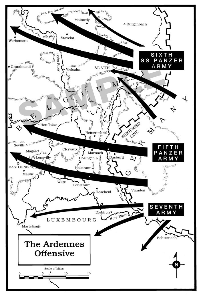
Appears in Alamo in the Ardennes by John C. McManus published in 2007 by John Wiley & Sons, Inc. Copyright 2007 Rick Britton. 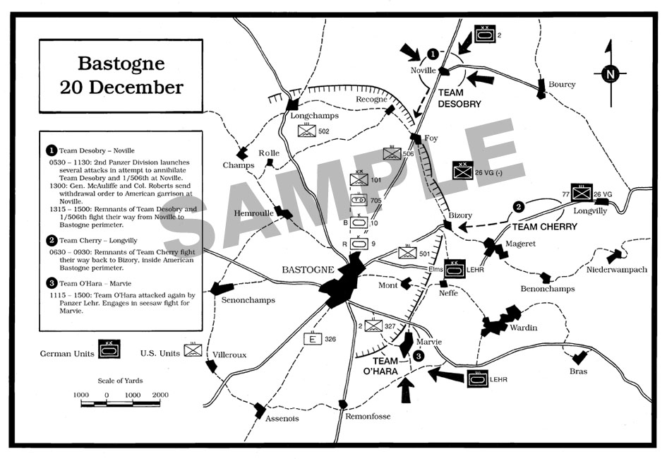
Appears in Alamo in the Ardennes by John C. McManus published in 2007 by John Wiley & Sons, Inc. Copyright 2007 Rick Britton. 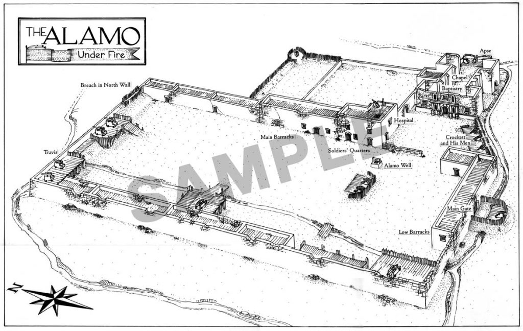
Copyright 1997 Simon & Schuster. Appears in Empires Lost and Won: The Spanish Heritage in the Southwest. 
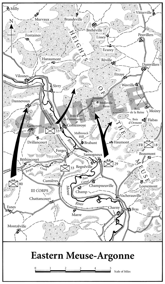
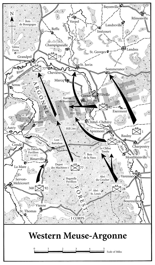
From To Conquer Hell by Edward G. Lengel published in 2007 by Henry Holt and Company LLC. Copyright 2007 Rick Britton. 
Copyright 1999 Atheneum Books, an imprint of Simon & Schuster. This map appears in Army Nurses of World War II. 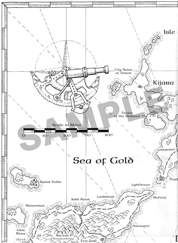
Copyright 2003 Aurigas Aldeberon LLC, a publisher of role playing products. 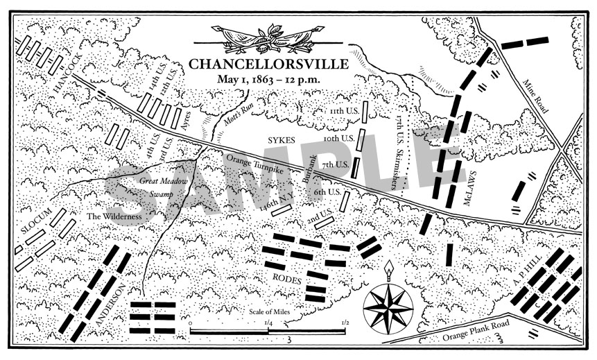
Appears in American Courage, American Carnage: The 7th Infantry Regiment’s Combat Experience published by Tom Doherty Associates, LLC. Copyright 2009 Rick Britton. 
Copyright 2005 Rick Britton. From Ed Lengel’s General George Washington published by Random House in 2005. 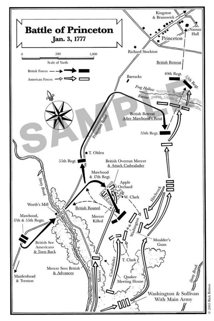
Copyright 2005 Rick Britton. From Ed Lengel’s General George Washington published by Random House in 2005. 
Copyright 2005 Rick Britton. From Ed Lengel’s General George Washington published by Random House in 2005. 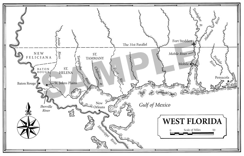
Appears in Borderlines in Borderlands by J. C. A. Stagg published by Yale University Press. Copyright 2008 Rick Britton. 
Appears in American Courage, American Carnage: The 7th Infantry Regiment’s Combat Experience published by Tom Doherty Associates, LLC. Copyright 2009 Rick Britton. 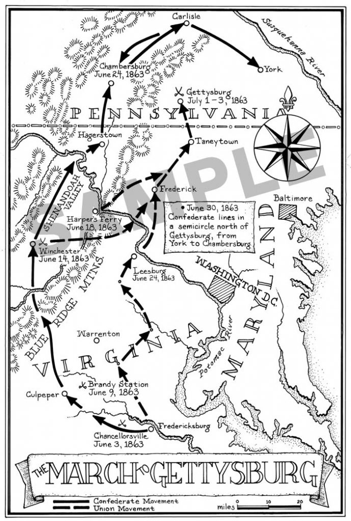
Copyright 1995 McElderry Books, an imprint of Simon & Schuster. This illustration appears in To Hold this Ground, a Civil War book for young readers. 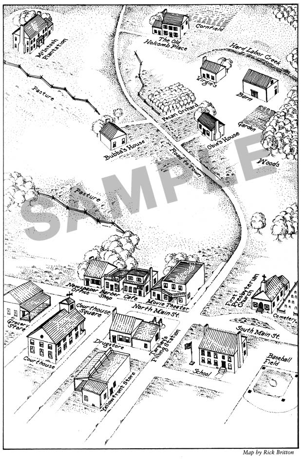
Copyright 1997 Atheneum Books, an imprint of Simon & Schuster. This perspective of a small-town-America map dot appears in Under the Shadow of Wings. 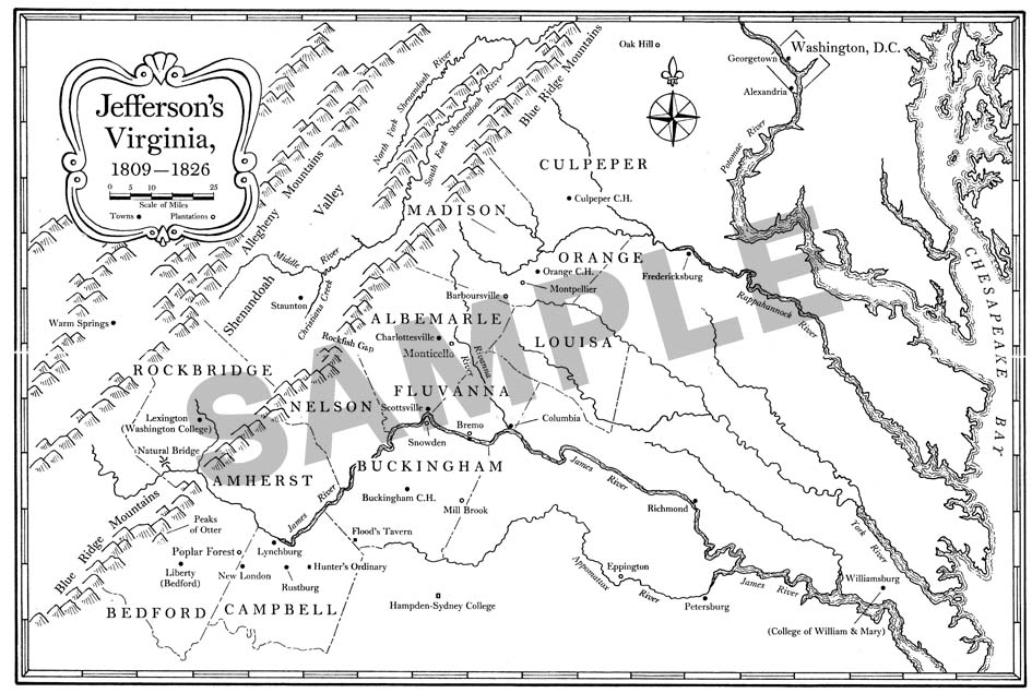
Copyright 2005 Princeton University Press. From The Papers of Thomas Jefferson; Retirement Series, Volume 1. 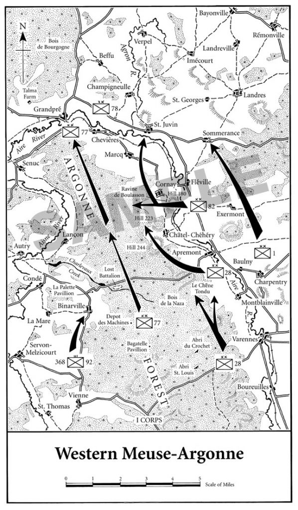
From To Conquer Hell by Edward G. Lengel published in 2007 by Henry Holt and Company LLC.
Copyright 2007 Rick Britton.
Copyright 2005 Rick Britton. From Ed Lengel’s General George Washington published by Random House in 2005. 
Copyright 2007 Rick Britton.